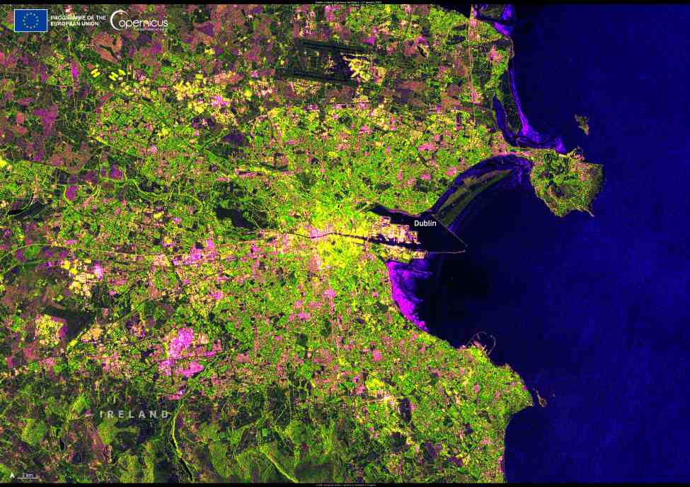
Dublin, Ireland, appears in striking detail in this radar image captured by the Copernicus Sentinel-1C satellite on 17 January 2025. As a major cultural and economic center, Dublin is home to historic landmarks, renowned institutions, and a vibrant urban landscape.
The Copernicus Sentinel-1C mission, launched in December 2024, is the latest addition to the European Union’s Earth observation program. Equipped with advanced synthetic aperture radar (SAR) technology, Sentinel-1C can capture high-resolution imagery regardless of weather or lighting conditions, supporting environmental monitoring, disaster response, and climate research.

This successful deployment follows the launch of another Copernicus satellite, Sentinel-2C, designed to provide optical data for applications ranging from wildfire detection, floods and droughts to agricultural planning. Together, these satellites enhance the resilience of the Copernicus system, ensuring the continuous availability of critical Earth observation data.
Sentinel-1C’s first radar images, processed by the Copernicus Ground Segment, demonstrate its exceptional capabilities. One of its earliest images, taken just over 56 hours after launch, featured Svalbard, a Norwegian archipelago in the Arctic Ocean. Now, with detailed images of European cities like Dublin, the satellite is beginning to fulfill its role in delivering essential data for scientific and operational use.
Featured image credit: European Union, Copernicus Sentinel-1C imagery


