Explore the Maya ruins of Guatemala's northern Petén department
Venture beyond Guatemala’s famed Maya ruins at Tikal and you’ll find family-run museums and communities preserving age-old traditions, and an opportunity to learn about the country’s history from those who call it home.

The fall of the ancient Maya civilisation came gradually — as did the disappearance of its centres of power, each one slowly reclaimed by the creeping jungle. Mighty cities were lost for centuries, biding their time beneath thick drapes of vines and moss like dust sheets. In Guatemala, after the curtain was drawn back, hoards of artefacts eventually made their way to the National Museum of Archaeology and Ethnology in Guatemala City, one of the largest troves of Maya antiques. But other relics wound up in much smaller collections — like the one I come across by chance on a small private island in Lake Petén Itzá, far from the capital in the country’s wild north.
I first spy the isle from the bigger, neighbouring island of Flores, home to a namesake port town. I’m in the city as a gateway to Tikal, one of Central America’s largest and most famous Maya archaeological sites, a 90-minute drive north. Visiting ancient Maya settlements is a highlight of any trip to Guatemala; the country is located at the geographical heart of the ancient Maya world, and it’s home to more Maya ruins than any of its neighbours. There’s an especially high concentration here, in the northern Petén region, scattered around the Maya Biosphere Reserve, one of the largest tracts of forest left north of the Amazon.
Flores itself used to be the site of a Maya settlement known as Nojpetén (‘Great Island’), among the last independent states in the Americas to fall to the Spanish, at the end of the 17th century. Later abandoned for some 200 years, the island is now home to a brightly painted, colonial-style port town, lashed to the mainland by a modern, concrete causeway.
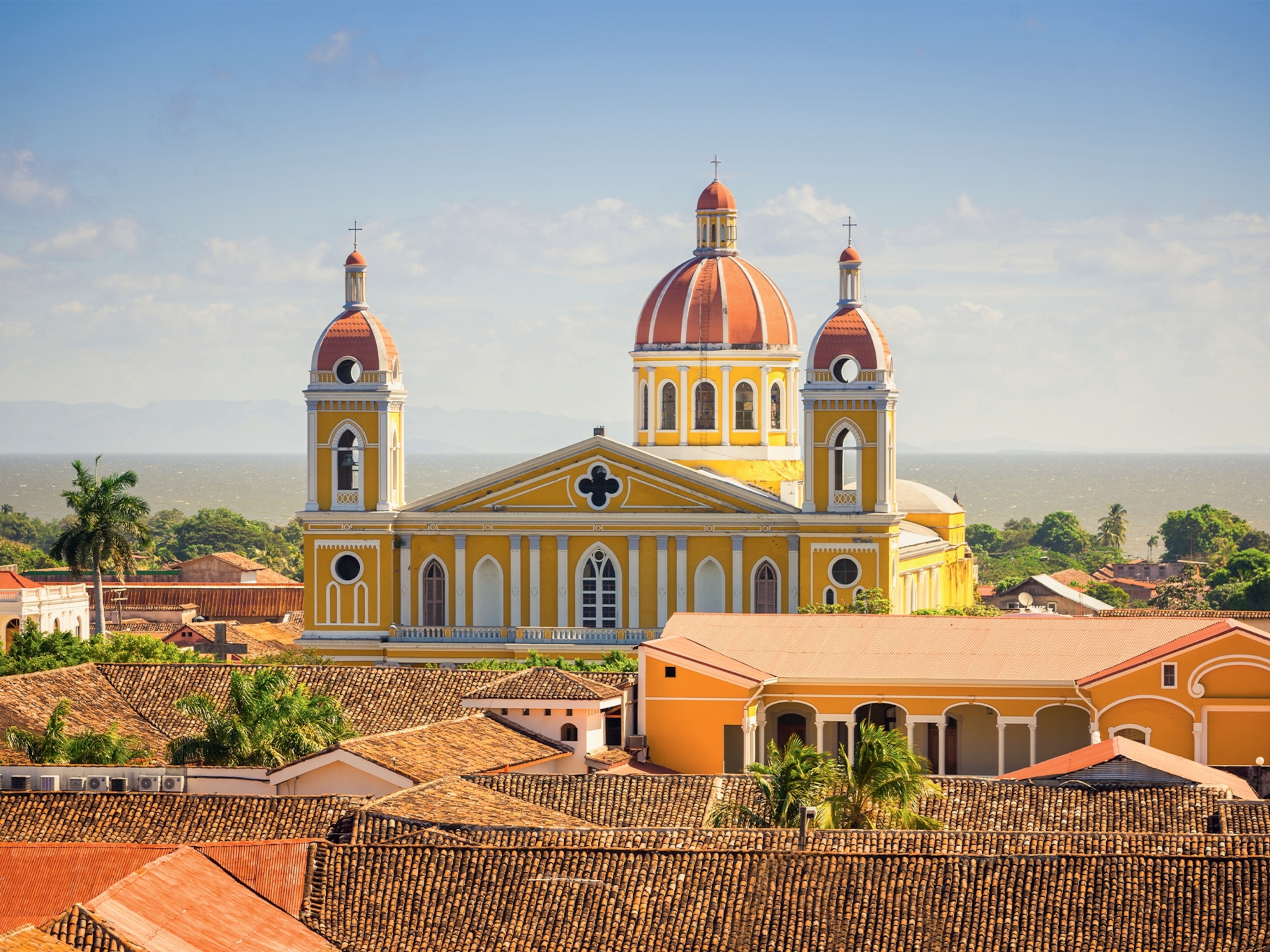
Locals have nicknamed it ‘Little Venice’ for its prettiness — and proneness to flooding. Certain streets at the edges of the lake are half-submerged, their lampposts sticking out of the water. The centre of town is at the top of a hill, around a plaza presided over by a white cathedral built on the site of a Maya temple, and ringed with ancient stelae (stone tablets) inscribed with Maya hieroglyphs.
But it’s that other island across the water, where a radio mast rises high over a compound, that I keep turning to. My guide Eulogio López Garcia, or ‘Locho’, says it’s entirely owned by a local family, who run the most unusual museum of Maya curios he’s ever seen. He does a quick deal with a boatman for a short charter to the island, the name of which neither of them knows.
“We call it Santa Barbara,” says María Magdalena González Galdes, the co-owner, an old lady in chunky white trainers who meets us on the dock. In the distant past, Santa Barbara was a ceremonial site. Later, it became a municipal waste ground. But María Magdalena and her late husband Emilio bought the place almost 60 years ago, cleaning it up to build a home and radio station.


Radio Petén still broadcasts from her house, a large clapboard bungalow, playing “a little news and a lot of music”, as María Magdalena says. A local DJ, Dalia Jimenez, is currently at work in the small but well-equipped studio just off the kitchen, responding to live requests via YouTube for Guatemalan pop hits and old marimba favourites.
After raising six kids here, María Magdalena is the island’s only permanent resident, unless you count her cats. “But people are always coming and going,” she says — not least to and from the annexe out back, where her husband and son, also named Emilio, built their museum.
The older Emilio transmitted to the younger his keen interest in Guatemalan history, and they both paid close attention to ongoing excavations in and around the Maya Biosphere Reserve. As María Magdalena explains, ceramics, carvings and funerary jewels would turn up from illegal digs and forest-clearing operations. Many were being sold for cash under the table.
Father and son started buying those artefacts to stop them from disappearing out of the country. They duly registered each one with the national Institute of Anthropology and History (IDAEH), by which means the holder of a given Maya artefact becomes its authorised custodian. The resulting collection is now stored and displayed in a room that feels half like a cluttered garage, half like a treasure trove.
Glass cabinets are filled with wooden masks, stone animal totems, flint carvings of the god of corn, obsidian tools once used to build the Maya cities of this province. In one display case there’s a well-preserved skull, discovered in the nearby town of Dolores, with holes drilled into the teeth for jade ornamentation. “They think it came from a human sacrifice,” says María Magdalena.
Reading the ruins
As I wander the ruins of Tikal the next day, I find it that much easier to picture a severed head bouncing down the steps of Temple I, more commonly known as Temple of the Great Jaguar for a lintel depicting a king on a throne of feline bones. It’s a 150-foot sepulchral pyramid of mossy limestone steps and, viewed from the ground, it ascends to a vanishing point like a pagan stairway to heaven.
Dated to the mid-eighth century, the Temple of the Great Jaguar still stands in the so-called Great Plaza as the centrepiece of Tikal. Set deep in the rainforest, the archaeological site was once one of the largest urban centres of the Maya. It reached its apogee during the Classic Period — the height of the civilisation, from around 200 to 900 CE — when much of the Maya region was ruled from here. The city was eventually abandoned in the ninth century; researchers have cited a mix of overpopulation, overexploitation of natural resources and megadroughts as possible explanations, though the exact reason remains a mystery.

The sprawling excavation is now both a UNESCO World Heritage Site and the heart of the 220sq-mile Tikal National Park — and it’s so iconic that it serves as the very model of a lost Maya city reclaimed from the jungle. Like many movie-lovers, I first saw Tikal from above as a kid, its upper tiers poking through dense forest in the 1977 fantasy classic Star Wars Episode IV: A New Hope. Screenwriter and director George Lucas used it as a setting for an alien planet for its otherworldly effect.
And like many visitors with little prior knowledge of the ancient Maya, I’m more inclined to fixate on their practice of human sacrifice than their knack for design. Locho tells me the practice was not as routine as I might think; the high priests only offered hot blood to the gods when they felt they had to. Founded some 20 miles north east of Lake Petén Itzá and its adjoining rivers, Tikal was especially susceptible to drought. This made their god of water most important to appease, and another highlight of Tikal’s Great Plaza is a monumental carving of his face, its features pushing out from the greenish-grey stone.
It’s a short walk through the complex to the next plaza, where another set of ruins is known as the Lost World. We follow behind a tour group climbing a protective scaffold over its Temple IV, or Great Pyramid, one of the tallest of the Maya world at 230 feet. From the platform on top, sunbeams flare off the stones, and the surrounding temples seem to float over the jungle — a view so stirring as to quiet everyone here.
As the human voices hush, the throaty squawks of toucans and distant screams of howler monkeys are amplified. For all the crowds passing through here, the animals far outnumber us, and the place belongs to them. I try to imagine the last men and women who abandoned this city some 1,100 years ago, their crops failing, systems collapsing, people disappearing off the face of the Earth.
Except they didn’t. As Locho reminds me, their descendants account for some 40% of the population of Guatemala, divided between 22 ethnic groups. His mother was Maya of the K’iche’ people — she spoke their language before she learned Spanish — but she never talked much about her heritage. “None of her generation did,” he says, referring to the once-widespread prejudice among the European-descended population against the Maya.
Locho himself only learned about Indigenous history while studying to be a guide. Having since visited Tikal many times, he wants to show me another, older city named Uaxactún, set so much deeper into the national park that few venture that far.
We reach this cluster of man-made structures at the end of a long, rough road, looming from the jungle like misshapen, oversized gravestones, and find it deserted. Tarantulas scarper for their burrows as we approach. Bats fly towards our faces from the darkened doorway of what Locho says used to be a residential palace. Jaguars might well be watching from the trees; Locho says he spotted two in his torchbeam before dawn last week.
To the Maya, these big cats signified nobility, ferocity and the darkness of night. Their likenesses are sculpted here into Temple E-II, or Temple of the Masks, on the site of what may have been the first astronomical observatory ever built by the Maya, circa 800 BCE. Its subtemples were seemingly configured to track the solstices and equinoxes, the cycles of Venus, the celestial trajectories. “The stars must have been so much clearer then,” says Locho.

Promoting & protecting
The sky today is more obstructed by trees, but seasonal rituals of the Maya calendar, including a festival to celebrate the spring equinox, have lately been revived on this site. “And they’re not just for show,” says Locho. There’s a local village of wooden houses and farmsteads, perched so close to the ruins as to share their name.
Uaxactún, meaning ‘Eight Stones’, was bestowed on the ancient city by American archaeologist Sylvanus Morley, who’s credited with its rediscovery in 1916. (Its original name is now believed to have been Siaan Ka’an, or ‘Born from Heaven’.) But Morley only learned of the location from a neighbouring encampment of gum-tree workers, who’d seen the jungle take strange shapes where it grew over those old Maya structures. Most of those labourers were Maya, says Locho.
Gum extraction is not the massive national industry it was then, and the grass has since covered that camp, too. But a settlement remains. Boys from Uaxactún play football on a field that used to be an airstrip for landing men and equipment at this outpost. Other residents are actively involved in protecting and promoting the ruins on their doorstep, hosting initiatives including guided tours and workshops on traditional craft techniques, using the likes of seeds, mushrooms and flowers gathered from the jungle. These projects earned them a nomination from the United Nations for Best Tourism Village in 2024, a programme that recognises destinations where tourism helps preserve cultures and traditions.
On the long drive back out of Tikal National Park, we pass more warps and distortions in the forest, where roots and vines suggest the silhouette of something else. Locho tells me any one of those contours might yield another tower or chamber or altar from a long-lost metropolis. Archaeologists would love to explore them if they were granted access and resources, but most people who live around here would rather they didn’t. “We can’t keep digging up everything,” says Locho, “not if we want to protect nature at the same time.”
The pre-Columbian people of Tikal and Uaxactún are something of a mystery today, he admits. Knowledge of the Maya writing system was lost among their descendants, and it’s only since the late 20th century that most texts have been deciphered. “But their culture is still alive,” he says, a soft-spoken man sounding suddenly emphatic. After all, Locho, who’s part K’iche’, is living proof. Whatever has been lost, the Maya world has never ended.
Plan your trip
To subscribe to National Geographic Traveller (UK) magazine click here. (Available in select countries only).